About
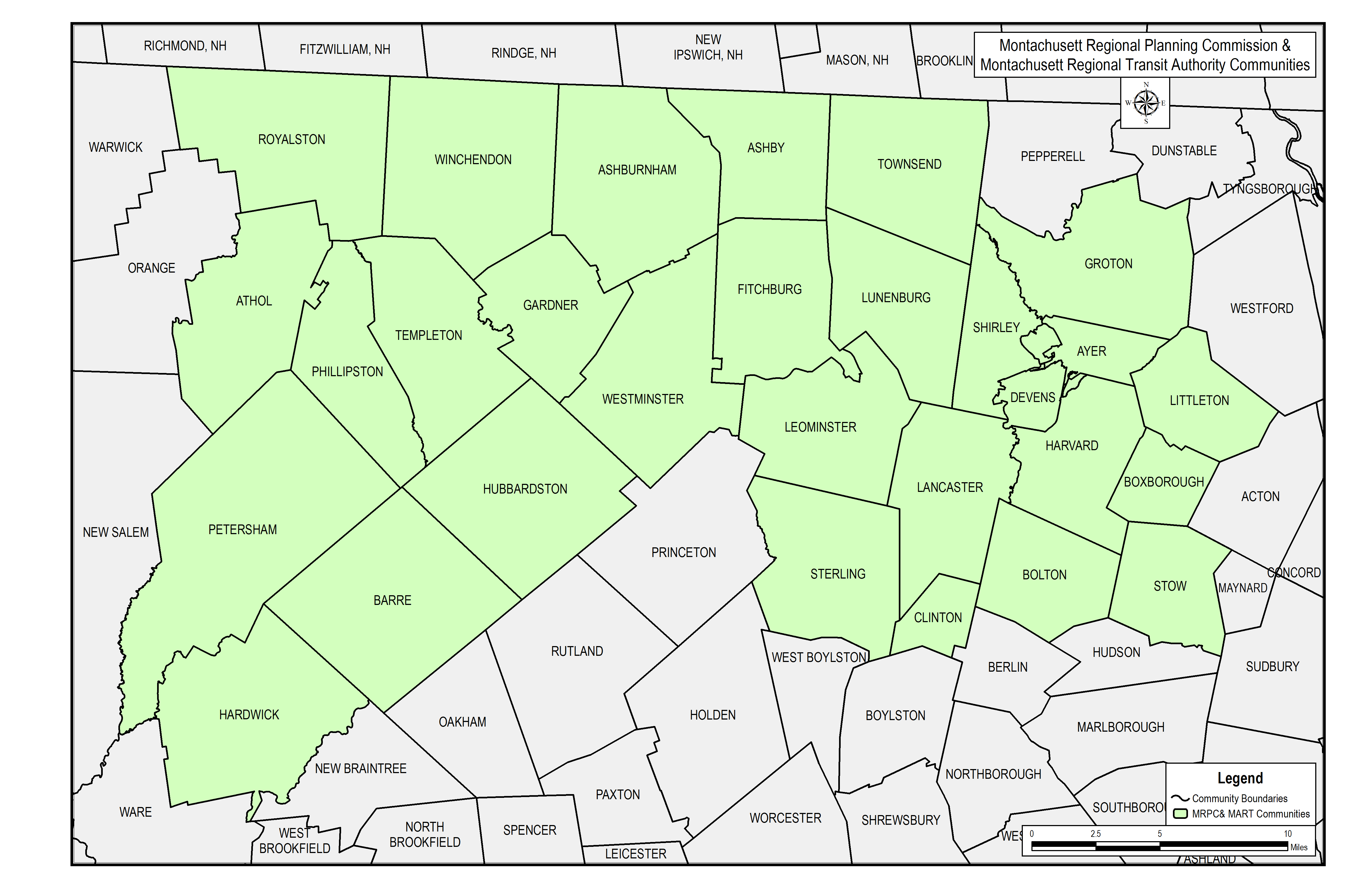
![]() Where are the MRPC and MART Regions?
Where are the MRPC and MART Regions?
The purpose of the Safety Action Plan is to improve roadway safety by significantly reducing or eliminating roadway fatalities and serious injuries through the development and implementation of plans that focus on the needs of all users: pedestrians, bicyclists, motorists, public transportation users, micro-mobility users, and commercial vehicle operators. Key outcomes of the plan include broad strategies for improving transportation in the MRPC/MART communities and a prioritized suite of safety improvement projects with a timeline for their implementation.
The Safety Plan will develop the tools to help strengthen the region’s approach to roadway safety and save lives. It will also include a list of short-, mid-, and long-term projects that will be eligible for implementation and supplemental planning funds through the Federal Highway Administration’s (FHWA) Safe Streets and Roads for All (SS4A) and other federal grant programs. The project team will work to hear the needs of residents, business owners, and daily commuters through multiple avenues of outreach to understand their experiences and develop a plan that responds to their concerns. While the principles of Vision Zero are universal, our goal is to develop a plan that responds to the unique conditions and needs of the MRPC region.
Major Aspects of the Project Include:
Develop a data-driven understanding of existing conditions including:
- Mapping crash clusters
- Reviewing the network to find deficiencies for vulnerable users (those walking, biking, or rolling outside of a motor vehicle)
- Evaluating the existing street network using a variety of factors including, but not limited to speeds, number of lanes, traffic controls, and volumes
Meaningful public engagement that attempts to reach and welcome a diverse range of stakeholders, with an emphasis on equity and outreach in communities traditionally underserved, including:
- A Project Steering Committee comprised of the municipal and civic leadership from MRPC communities with representation from MART.
- Meetings to encourage public comment and feedback.
- An online survey to identify high crash locations, areas of concern, unmet needs for those walking and biking, poor transit conditions, and other issues.
From technical analysis and interactions with the public, we will develop:
- A Vision Zero policy that reflects MRPC’s communities.
- An approach and safety strategies to reach Vision Zero
- Recommend projects to achieve the goals of the policy, which will be eligible for investment through SS4A and other federal or state roadway safety programs
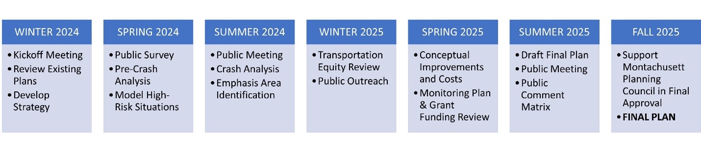
Project Timeline