What is GIS?
GIS is the acronym for Geographic Information System. A GIS:
- Is a comprehensive computer system capable of storing, editing, analyzing, and displaying geographically referenced (spatial) information.
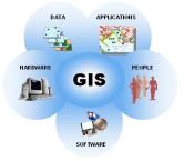
- Is comprised of hardware, software, data, and most importantly people who are trained in using a GIS. To see a flow chart that explains the basics of GIS click here (see MRPC GIS Flow Chart).
- Allows users to visualize, question, interpret and understand spatial data in order to reveal relationships, patterns and trends.
Click the links below to learn more about: